Big Tubes
| A rough but fairly level hike to and around two collapsed lava tubes. This trail takes you through an open forest containing a variety of trees such as aspen, ponderosa pine, piñon and juniper. The lava tubes to which you hike are large and long (one of the longest in North America). They are unlike anything else you will see while hiking. |
| Hike data | Waypoints | Maps | Getting to the trailhead | About the hike | Plants along the trail | Comments |
|
| Date: | 2000-09-16 |
| Time it took us: | 3:30. |
| Usage (people/hour): | No data. |
| Cleanliness: | 10. |
| Waypoint | Type | Description |
| 4WINDO | Cave entrance | Four Windows Cave entrance |
| BIGTUB | Trailhead | Big Tubes trailhead at El Malpais National Monument |
| BTSIGN | Trail junction | Big Tubes sign |
| CTRPLR | Trail point | Caterpillar collapse |
| Map name | Cartographer | Year | Scale | Topo map? | Online access | Notes |
| El Malpais Recreation Map and Guide | BLM | 2008 | 1:100000 | Y | from Amazon (purchase) | Great overview map for El Malpais area, including showing land ownership. |
| Geologic Map of El Malpais Lava Field and Surrounding Areas, Cibola County, NM | USGS (Charles Maxwell) | 1986 | 1:62500 | Y | No online copies. | For sale at the three visitor centers (NPS, BLM, Northern NM) around El Malpais. |
| Guide to Indian Country of Arizona Colorado New Mexico Utah | Automobile Club of Southern California | 1998 | 1:0 | N | from Amazon (purchase) | Good overview road map for northwest NM. No scale is given on the map. The corner coordinates are approximate. |
| Ice Caves | USGS | 1967 | 1:24000 | Y | from sar.lanl.gov (free) | |
| Wildernesses of New Mexico | US Forest Service | 1981 | 1:1000000 | N | No online copies. | Base map with national forests, wilderness areas and highways. |
Support this site:
By purchasing your hiking gear through these links, you will support this web site and it won't cost you anything more. Camping gear at Amazon


Take exit 81 from I-40 and head south for a total of 23.9 miles.
This is the El Malpais visitor center. It is a good idea to stop
in here and inquire about getting to the trailhead. If it has
rained recently, the road can be impassible. Also, check the
forecast to see if rain is likely.
|  |
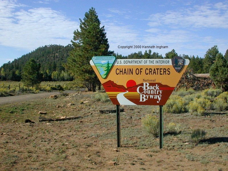 | Continue from the visitor center 3.6 miles to the junction with
County road 42. Turn left onto 42. A sign indicating that this
road takes you past the Chain of Craters will help you know you
have found the right road.
|
Drive about 4.1 miles down 42. You will see a sign indicating a
left turn to get to the Big Tubes area. Go left (this may be
indicated as NPS road 300).
|  |
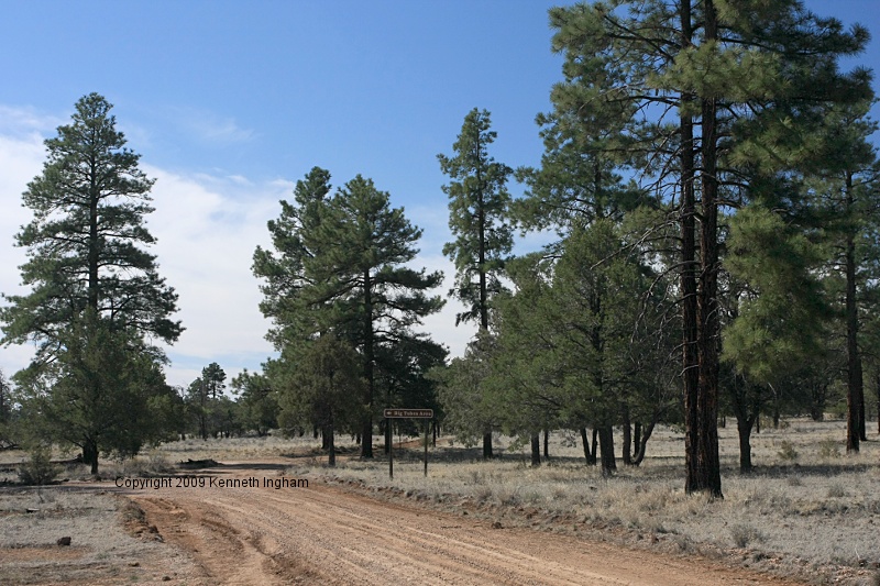 | After about 2.6 miles, a sign indicates the Big Tubes parking area to
your left.
|
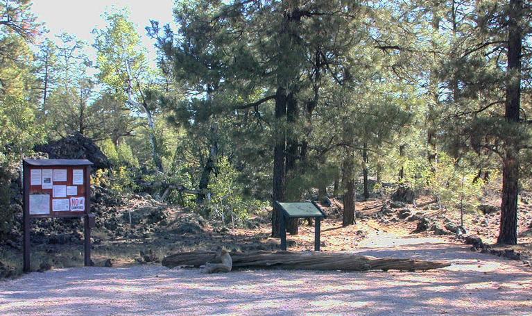
You have arrived. There is a small picnic area and vault toilet to the
left of the trailhead. My photos are on the sign that is angled.
|  |
 | The trail takes off from the east side of the parking lot This trail is a cairn trail. It is easy to follow, as the cairns are large and there are plenty of them. You start out walking in amongst Aspen and Ponderosa pine. The aspen end not long after you start, replaced by piñon and juniper. |
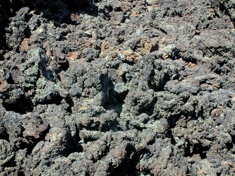
Some of the trail is across aa lava. This lava is rough, sharp,
and often clinks as you walk on it. Often, aa is formed of
varying-sized, loose pieces of rock. It is easy to twist an ankle, so
watch your step.
|  |
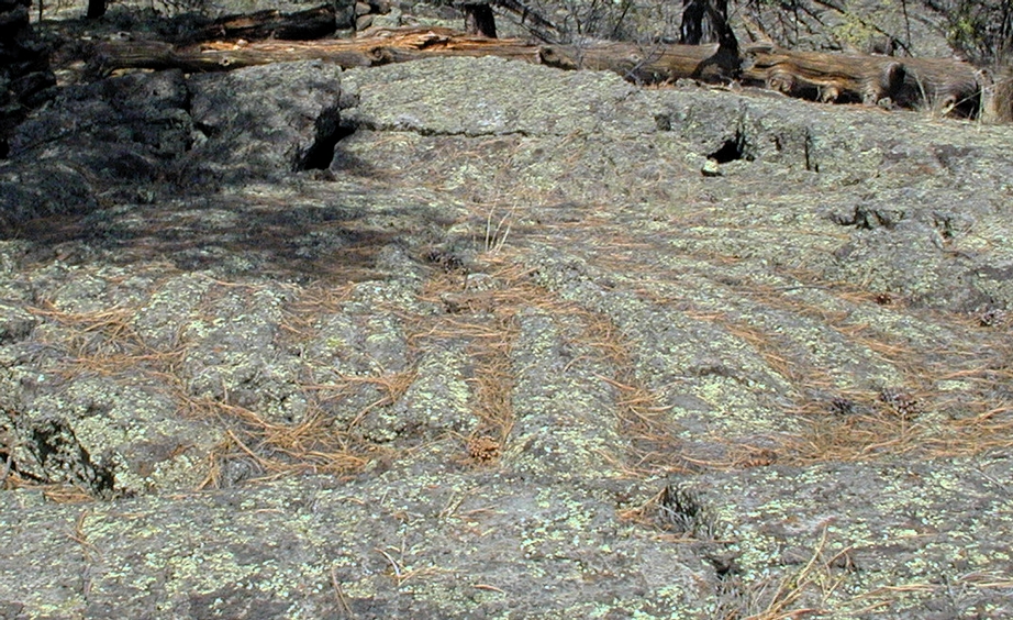 | The other predominant form of lava out here is pahoehoe. It is smoother,
sometimes ropy in appearance. You appreciate these differences in lava
after hiking on both of them. The pahoehoe is much easier to walk on.
This photo was taken by Diana Northup. |
After a little more than a quarter mile (about 0.5km), you come to a
sign indicating various choices you can make (GPS: BTSIGN). For this hike turn left,
heading towards Caterpillar collapse. You will return from the right.
|  |
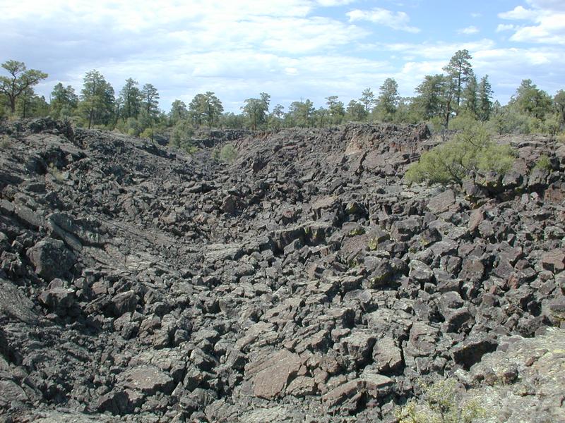
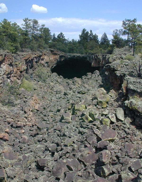 | Off on your right is one of the large lava tubes with portions collapsed.
This trench contains Big Skylight cave. Note that all caves are currently
closed on the monument, so do not enter them.
|
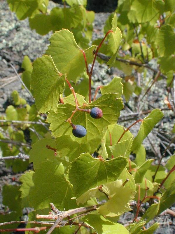
The trail follows this trench for a while. Besides getting different
views of the trench, you get a chance to see some of the plant diversity
out here. For example, the trail goes past some wild grapes (pictured
here).
|  |
 | |
You leave Four windows and cross a bridge across the trench, where you will find a sign and a cairn. You can return to Big Skylight cave by following the cairn trail which takes off behind you as you look at the sign. However, doing so would prevent you from seeing Seven Bridges. Therefore, follow the cairn trail which leads to the right of the sign. A view up the trench showing one of the bridges is to the right. From here, follow the cairn trail up the trench and back to Big Skylight Cave, where you find the trail back to the parking lot. | 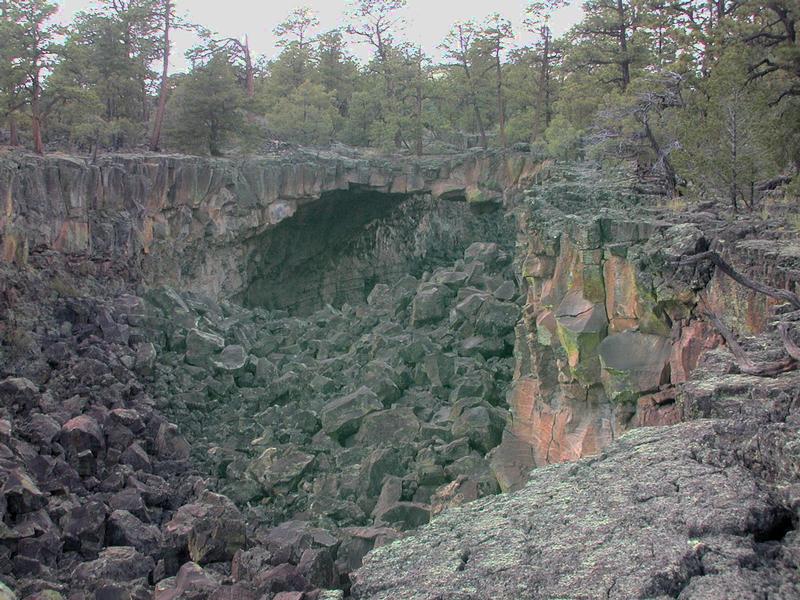 |
Plants we saw along the trail:
Reader comments about this hike:
Add your comments about the Big Tubes hike.
|
Copyright © 1997-2018 Kenneth Ingham Consulting, LLC.
For details about the copyright, see the full Copyright statement.
Unhappy? Thinking of suing us? Read this disclaimer.
You can read our privacy statement.
This is an excellent review of this trail, with good directions to find the trail head. Finding the trail head could be difficult without these directions. I have hiked this trail several times and explored the lava tubes. Please be aware that safety equipment is very important in the lava tubes, follow advisories regarding 3 light sources, helmets, gloves and good sturdy hiking boots. Thank you for your professional descriptions of this hike, and all of the attachments. On Fri Jul 7 21:14:08 2006 jay davis from mcqueeney,Texas said:
If you get off the main trail it is easy to get lost.Take plenty of water,also a whistle or small airhorn.The lava absorbs sound so hollering cant always be heard easily. i got lost for 6 hours on july 04 2006 On Sat May 10 17:31:18 2008 Joe Bertrand from Somewhere said:
Just got through hiking the trail. FABULOUS. I am a little out of shape (but not bad for a 45 yr old)so my quads were a little shaky 1/2 way into the trail. Going inside the tube was very interesting and going up the hole to get out was somewhat thrilling. Going down to Caterpillar Crawl I saw a baby rattlesnake. Not sure what kind, but it sure was cute. On Sat Jun 14 12:33:03 2008 Dennis from Duncanville Texas said:
In the early 1970's I hiked with Albq Sierra Club to a BLM-controlled area (not El Malpais) where we explored several subway tunnel sized lava tubes. (I toted a car headlight wired to a gel cell battery for light.) We also took a side trip to a small and steep, closed-ended tube that was full of ice. Inside, past a tight squeeze, were walls covered with ice crystals, while the rear of the cave was thick with what someone called fossil ice. Buried in the ice at the floor was the top of a ladder. Speculation was that the cave was used as cold storage by indians and possibly by guanno miners. I have a few B&W photos of the cave, but there isn't enough detail in them to reveal anything useful. I've long forgotten how to find this cave and every time I mention it I get the same answer, the known ice cave is the commercial one near Grants. Does anyone know how to find this BLM cave, and, more importantly, will they admit it? Thanks