
Canyon Overlook Trail
| A short, easy trail that ends with an excellent view of Fajada Butte and much of the rest of Chaco canyon. |
| Hike data | Waypoints | Maps | Getting to the trailhead | About the hike | Plants along the trail | Comments |
|
| Date: | 2001-04-14 | 2017-05-07 |
| Time it took us: | 0:30. | 0:53. Moving time from the GPS. We also spent over an hour looking at plants, eating lunch, taking photos, etc. |
| Usage (people/hour): | 2.00. I saw only one person when hiking it, but given the proximity to the Gallo campground, I would expect it to be a well-used trail. | 1.00. We saw two people. Hiking on a Sunday after everybody has left the campground, few people are around. |
| Cleanliness: | 10. | 10. No litter along the trail |
| Waypoint | Type | Description |
| CCCOT | Trailhead | Chaco Canyon Overlook trailhead |
| Map name | Cartographer | Year | Scale | Topo map? | Online access | Notes |
| Guide to Indian Country of Arizona Colorado New Mexico Utah | Automobile Club of Southern California | 1998 | 1:0 | N | from Amazon (purchase) | Good overview road map for northwest NM. No scale is given on the map. The corner coordinates are approximate. |
| Wildernesses of New Mexico | US Forest Service | 1981 | 1:1000000 | N | No online copies. | Base map with national forests, wilderness areas and highways. |
Support this site:
By purchasing your hiking gear through these links, you will support this web site and it won't cost you anything more. Camping gear at Amazon


The National Park Service has made it much easier to find the park than in days gone by. You used to have to guess which road to take whenever you came to a fork. They now have good signs all the way in. They also have a map online. From Cuba, take US 550 (old NM 44) past Counselor and Lybrook. Just past mile marker 112 is the turnoff, which is across the street from the Red Mesa Express gas station and convenience store. A sign indicates the turnoff to the left. The route is well signed. After about 4.7 miles, you will turn right from the paved road onto a dirt road, county road 7950. Beware that the dirt road sometimes gets exciting when it rains. Do not cross the washes if there is any water running. 16.4 miles from the turnoff from US 550, the road turns left, and again, there is a sign here. When the road becomes really washboard-y, you are getting close. At 19.4 miles from US 550, you enter the park. The trailhead is at the entrance to the Gallo Campground, which is on your right 1.5 miles after you enter the park. | 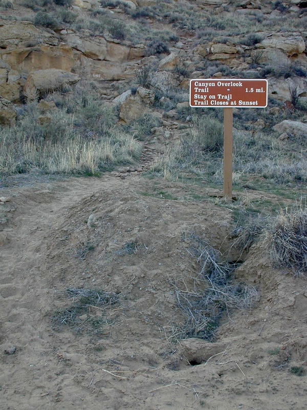 |
 | The trail heads up the cliff behind the sign. Climbing to the mesa top is all the climbing you will do on this trail. About halfway up the cliff, you can see a shelter cave which is mostly blocked off by rocks. Maybe for sleeping? |
On top, you almost immediately get views of Fajada, such as this one. |  |
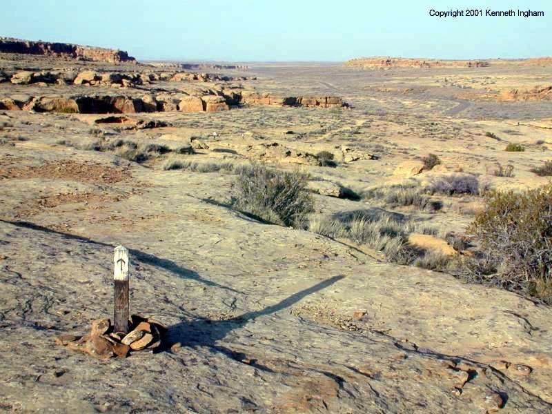 | You follow cairns, and sometimes the cairns are a little hard to spot, but with careful looking I was always able to find the next one. Other times, I could see several at once. Once you are on top of the mesa, you follow trail markers, such as the one in the photo to the right. The last post is hard to see; when you get near the cliff edge with a nice view of Fajada, that is the end of the trail. If you brought your GPS, CCCOT is the end of the trail. Also, you can find it by looking to the left of the way you were heading on the trail. This direction takes you towards the cliff edge, and you can see a pictograph holding a stop sign indicating the end of the trail. |
Plants we saw along the trail:
Reader comments about this hike:
Add your comments about the Canyon Overlook Trail hike.
|
Copyright © 1997-2018 Kenneth Ingham Consulting, LLC.
For details about the copyright, see the full Copyright statement.
Unhappy? Thinking of suing us? Read this disclaimer.
You can read our privacy statement.