Hyde Park Circle Trail
| A trail with excellent views of the Sangre de Cristo, Jemez, Sandia, San Pedro, and Ortiz mountains (i.e., views in most all directions). This trail gains 855 ft (261 m) in the first 0.94 mi (1.5km). However, the climb is worth it for the views. |
| Hike data | Waypoints | Maps | Getting to the trailhead | About the hike | Plants along the trail | Comments |
|
| Date: | 2002-08-11 | 2004-08-28 |
| Time it took us: | 3:00. | 3:00. |
| Usage (people/hour): | 2.67. Most of the people are on the trail behind the campground. I only saw two people on the ridge portion of the trail. | 0.50. I saw nobody on the ridge. I could hear people in the park as well as the traffic on the road for much of the hike. The park gets heavy use due to its proximity to Santa Fe. |
| Cleanliness: | 9. | 9. |
| Waypoint | Type | Description |
| HMPLP | Trailhead | Hyde Memorial State Park visitor center and trailhead for the loop trail |
| HPLP2 | Trail junction | Hyde Park Circle Trail crossing the campground road |
| Map name | Cartographer | Year | Scale | Topo map? | Online access | Notes |
| Guide to Indian Country of Arizona Colorado New Mexico Utah | Automobile Club of Southern California | 1998 | 1:0 | N | from Amazon (purchase) | Good overview road map for northwest NM. No scale is given on the map. The corner coordinates are approximate. |
| McClure Reservoir | USGS | 1976 | 1:24000 | Y | from sar.lanl.gov (free) | |
| Pecos Wilderness, Santa Fe and Carson National Forests | US Forest Service | 2004 | 1:54000 | Y | from Amazon (purchase) | |
| Santa Fe | BLM | 1996 | 1:100000 | Y | from Amazon (purchase) | |
| Santa Fe | USGS | 1954 | 1:250000 | Y | from sar.lanl.gov (free) | |
| Santa Fe National Forest | US Forest Service | 2004 | 1:126720 | N | from Amazon (purchase) | East half |
| Wildernesses of New Mexico | US Forest Service | 1981 | 1:1000000 | N | No online copies. | Base map with national forests, wilderness areas and highways. |
Support this site:
By purchasing your hiking gear through these links, you will support this web site and it won't cost you anything more. Camping gear at Amazon


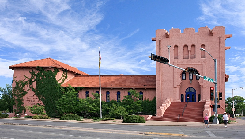
From the Santa Fe plaza, head north on Washington Ave. Just past the
pink Scottish Rite Temple (pictured here), turn right on Artist road; the
sign says that Hyde State Park and the Santa Fe Ski Basin are this way.
|  |
 | Drive seven miles to the Hyde Park Visitor's Center. Park in the
visitor center parking lot and pay the park day use fee.
The trailhead (shown here) is across the road from the visitor center.
|
 | You start by crossing a bridge over the Little Tesuque Creek. You can
barely see it in the trailhead photo above. While this trail's elevation is not
large compared to many hikes we have done, the elevation gain happens
in a much shorter distance. You get to start climbing as soon as you
cross the creek, and you will be climbing almost non-stop for the first
third of the hike. The initial part of the hike is in and out of shade,
and as a result, the sun can be hot. Make sure that you take enough
water on this hike.
Here is an early view south, with some of the trail in it.
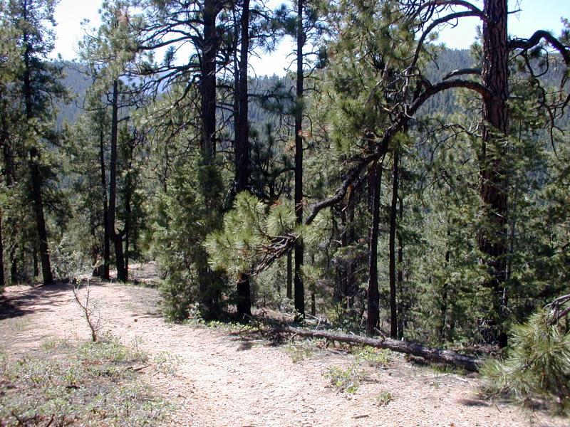
As you are climbing, the trail at times has some level parts. Enjoy
these---they are a welcome respite.
|
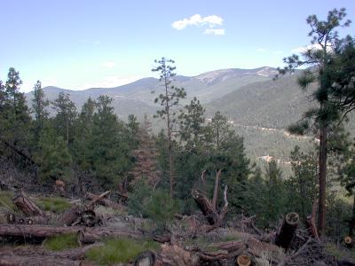
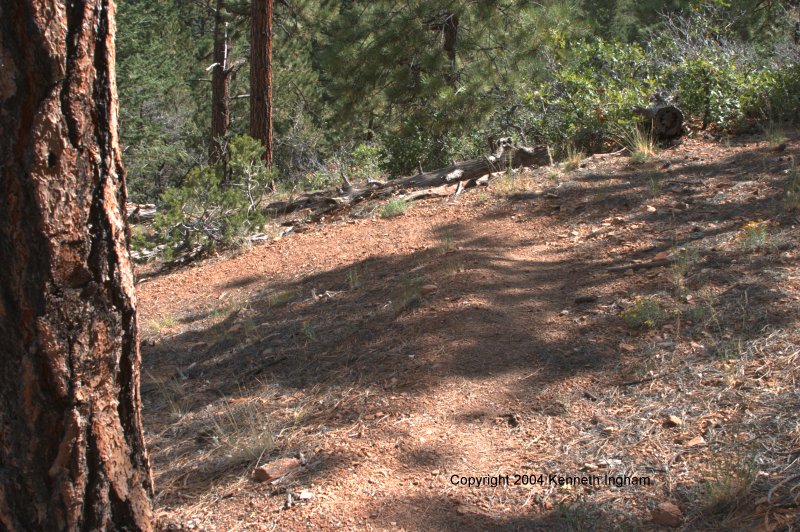
As you climb, you can see Black Canyon, where the campground is, however, you cannot see the campground itself. As you continue to climb, take regular stops to view the scenery; the views on this hike are great, and at one time or another, you get views off in all directions. This view is to the SSE. | 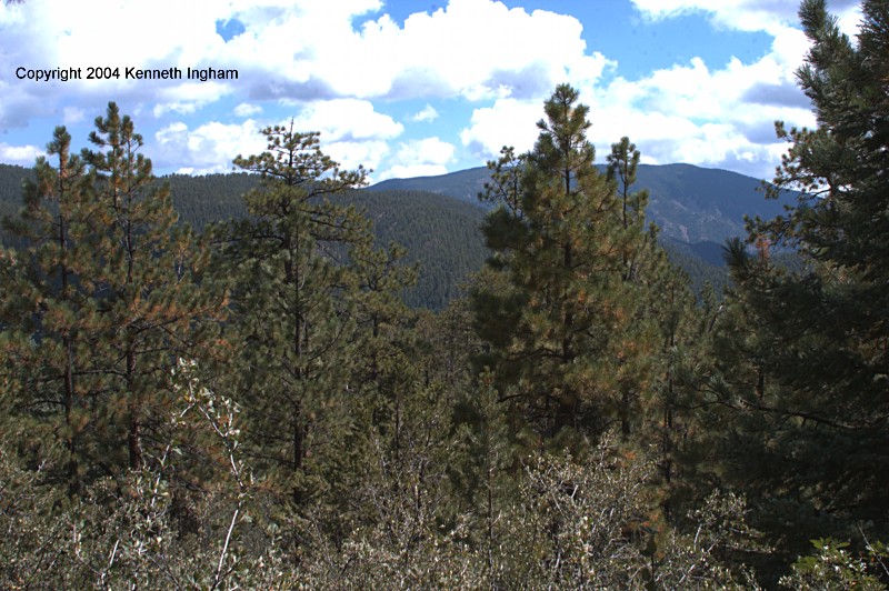 |
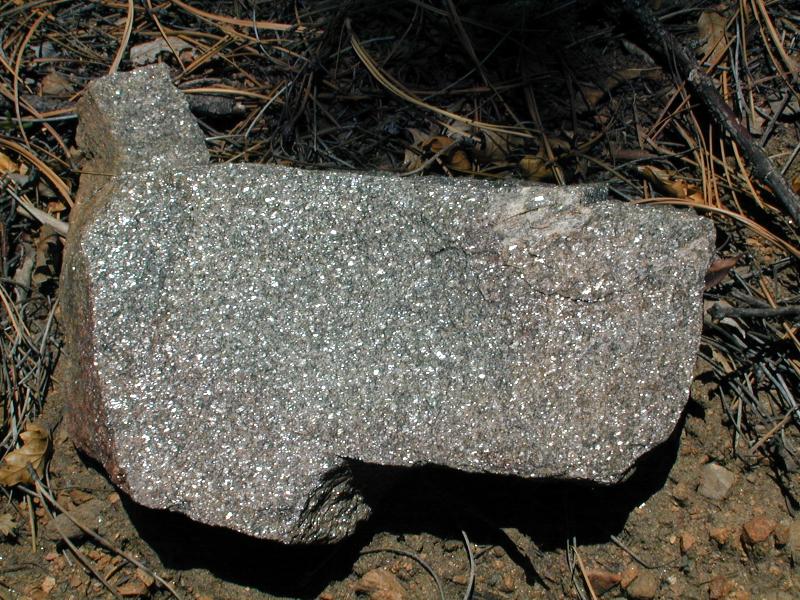 | When you have been hiking around 40 minutes or so, you reach a ridge line where you may get more breeze. I certainly appreciated the cooling air. The trail is on granite and decomposed granite. Granite is made of feldspar, quartz, and mica. Sometimes you will see a bunch of only one of these minerals, or rocks which a preponderance of one. For example the rock in the picture has a lot of mica in it. Another reason to look for the micaceous rocks is that they indicate that you are nearing the top. |
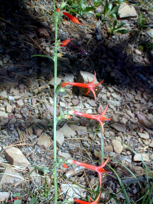
When we first hiked this trail, New Mexico had been in a serious drought
for a while. As a result, there were few wildflowers. However, this
Scarlet Gilia (also known as a Scarlet Skyrocket) was making a go at it.
|  |
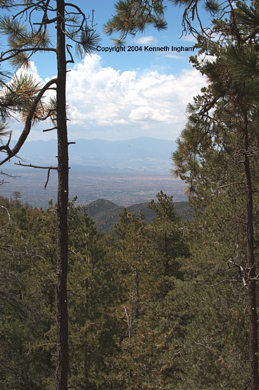 | When you start getting views off to the southwest (Santa Fe, the San Pedro Mountains, the Sandia Mountains) and west (Jemez mountains), you can be happy for many reasons. One is for the views. Another is because you are nearly at the top of the hike. This view is to the WNW, and you can see the Jemez in the distance. |
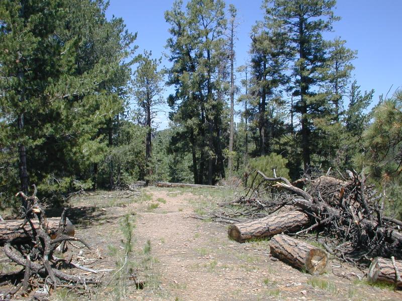
When you start to see trees down all around you from winter damage, you
have reached the end of the big climb. Take a break, smell the forest,
and drink some water.
|  |
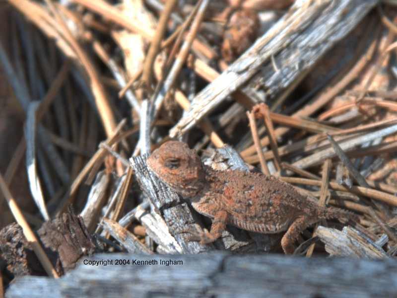 | I shared the trail with this granite-colored horned lizard. He or she
was gracious enough to allow me to take this photo.
|
Enjoy the views of the Sangre de Cristo mountains. When the trail heads down, this is not really the beginning of the trek down. | 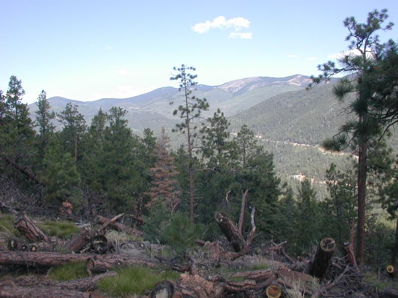 |
 | Right after a short climb, you reach a pair of picnic tables. These
always strike me as odd, because normally I expect tables to be near a
road. I wonder how they got up here. They make a nice rest before
heading downhill.
|
From the picnic tables, the trail used to have two branches. You could go past the picnic tables, or start down here. If you have older guidebooks, they will mention this. I took this older branch the first time. The park has changed the trail; you should take the trail that goes down. They indicate it with tree trunks on either side of the trail. When I took this photo, I was standing near the second picnic table. | 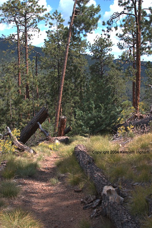 |
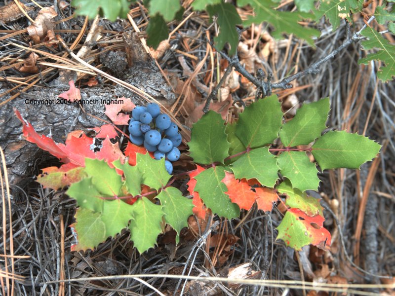 | The forest is different on the way down. You are walking through more shade. The second time we hiked this trail, the Oregon Grape were getting ripe. The turning leaves and ripening berries indicated that autumn was on its way. |
The trail heads down, steeply at times (hiking poles may be useful).
You also go around several switchbacks (such as this one). Please do not
cut across the area between the switchbacks; doing so is even steeper,
and it can cause erosion problems on the trail.
|  |
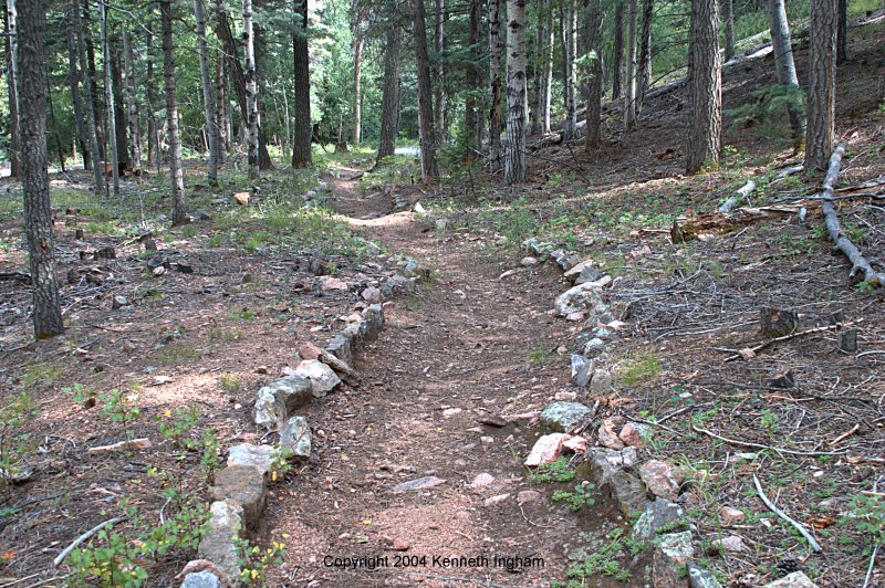 | When you get near the bottom of the hill, you will reach a junction.
This is the Girl Scout Joe M. Clark memorial nature trail.
The two paths will both take you to the trailhead for the nature trail.
I took the lower branch. You will know you are on this trail when
the trail is rock-edged.
|
When you reach the trailhead for the nature trail, you have several
options. You could walk along the highway back to the trailhead.
However, a better choice is to cross the highway, and go uphill just past
the ice skating pond. You will find this bridge. Cross it, and on the
other side, go up and to the left.
|  |
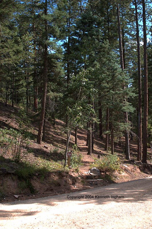 | When the trail gets to the gravel road, you should see this trailhead across the road (GPS: HPLP2. This trail is one of several that runs behind the campgrounds. All should eventually take you to the visitor center. A ranger warned me that this trail goes through a couple of campsites. If you continue in the direction you were heading, you will find the trail picks up again. This was good advice, as I would have been quite confused had he not mentioned it. You go right through campsites 17 and 15. The trail takes up again on the other side of the road, on the right side of site 15. Also, one time I obviously made a wrong turn and the trail I was on died out. I headed downhill and found the real trail again. |
Plants we saw along the trail:
Reader comments about this hike:
Add your comments about the Hyde Park Circle Trail hike.
|
Copyright © 1997-2018 Kenneth Ingham Consulting, LLC.
For details about the copyright, see the full Copyright statement.
Unhappy? Thinking of suing us? Read this disclaimer.
You can read our privacy statement.