Three Rivers Petroglyphs

The Three Rivers petroglyph site contains one of the most numerous collections of petroglyphs in the nation. Of the various petroglyph sites in New Mexico we have visited, this site has by far the most. BLM says that there are over 21,000, and many are in excellent condition.

In addition to the petroglyphs, you also get great views of Sierra Blanca and the Tularosa basin.

Petroglyphs along the trail

Hike data:

Controlling agency: Bureau of Land Management; hike web site
Location in the state: South-central;
Trailhead waypoint(s): 3RIVERS 3RIVERSSHR
Elevation:
start: 5009ft; 1527m end: 5009ft; 1527m
min: 4980ft; 1518m max: 5088ft; 1551m
Elevation gain/loss: 193 ft; 59 m. Elevation informtion from GPS data.
Length: 1.16 mi; 1.87 km.
How long it took us (HH:MM): 02:00.
Cleanliness: 10/10
Trail usage: 10.50 people/hour
Trail Condition: The trail is gravel with some rocks, and it is well-maintained.
Fee: $2.00. This fee also covers camping in the non-RV campsites; see the Three Rivers BLM campground for details.
When we hiked it: 2005-03-19.
Trailhead facilities: Water, trash cans, toilets, picnic area. The trailhead is at the Three Rivers BLM campground.
Special features of the hike: History, scenery.
When to hike: All year. Snow might affect the ability to hike this trail, but I would not expect it to last long. Summer is likely to be hot.
General comments:

The trail is interpreted. Pick up a guidebook at the trailhead.

Maps:

  • USGS 1:24000 Three Rivers
  • USGS 1:100000 Tularosa
  • USGS 1:250000 Tularosa
  • BLM: Tularosa
Map showing the location of the trailhead

Getting to the trailhead:

On US 54 between Carizozo and Tularosa, between mile posts 96 and 96 is a large sign indicating a turn to the east on Otero county road B030, also known as Three Rivers Road and forest road 579. Take this road about 5.3 miles. At the sign indicating that the petroglyphs are 0.25 miles to the left, turn and the road dead-ends at the petroglyph campground and parking lot.

The trailhead is under the shelter pictured at the right.

Trailhead

The hike:

Diana Northup on the trail
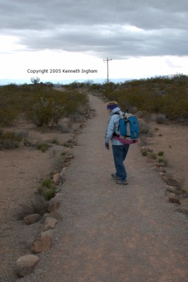
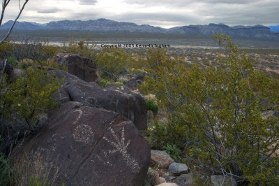
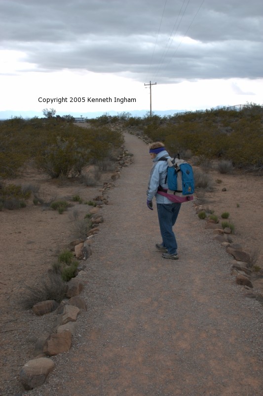
From the trailhead, you walk on the gravel trail and then pass through a pedestrian gate. Climb a slight hill, and you get to a bench with binoculars. This site (as well as much of the trail) would be an excellent one for evening or morning photos. From here, you can see White Sands gleaming in the distance. In this photo, if you look at the large version you can just see the bench and binoculars at the end of the trail (under the 2005 in the copyright statement).
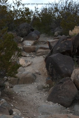
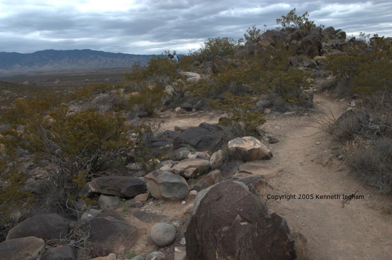
The trail divides several times. Take one side on the way out, and the other on the return trip.
trail dividing
roadrunner petroglyph
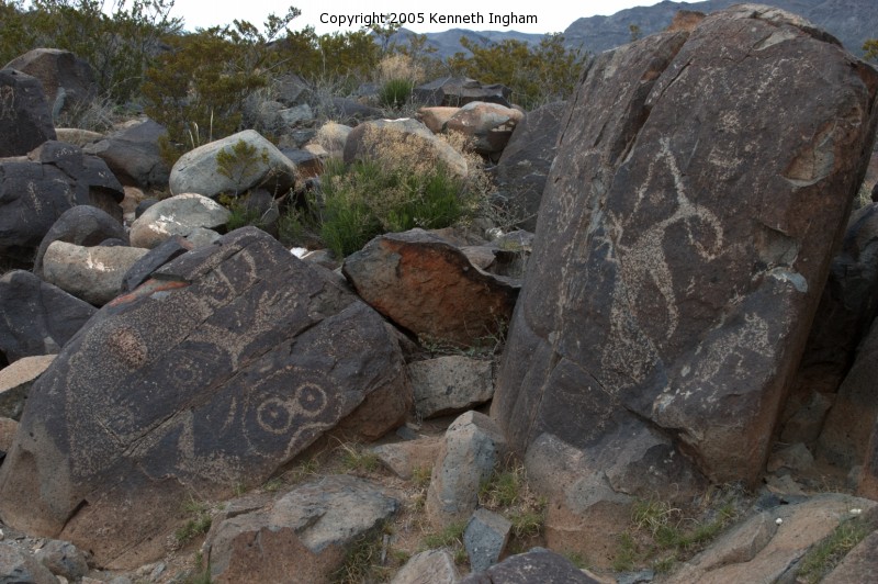
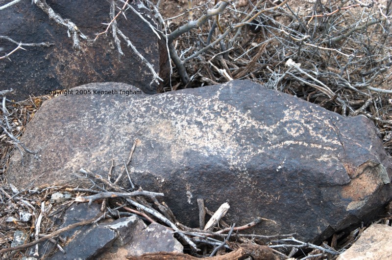
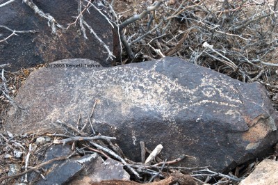
One of the early petroglyphs is this roadrunner.
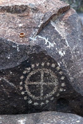
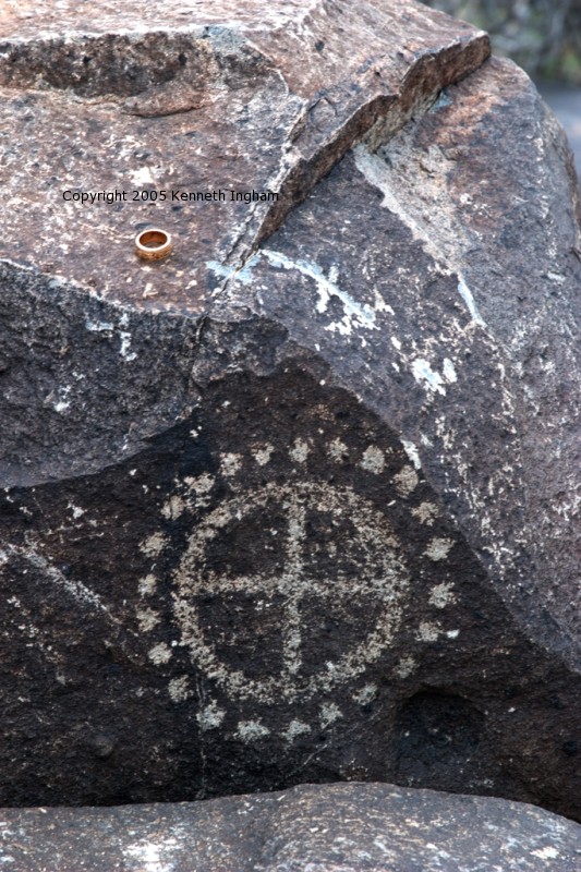
This circle with dots motif appears frequently. I wonder what it represents.
petroglyph of a + in a circle surrounded by dots
bighorn sheep petroglyph
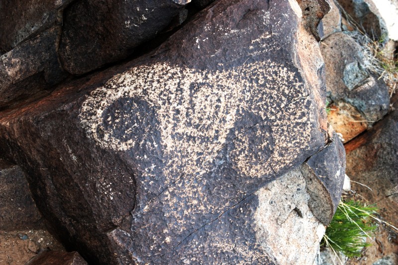
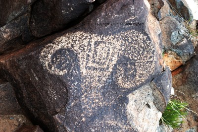
Animals obviously were important to the people who left their mark. Here is a bighorn sheep.
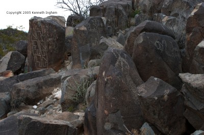
Many areas are quite dense with petroglyphs.
lots of rocks with petroglyphs
bighorn sheep with arrows in it
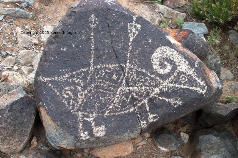
Hunting is portrayed by this bighorn sheep with arrows in it.
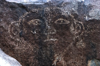
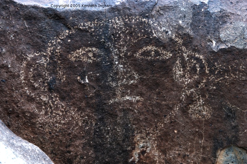
This is an early picture of someone wearing earrings.
someone wearing earrings
petroglyphs and the trail
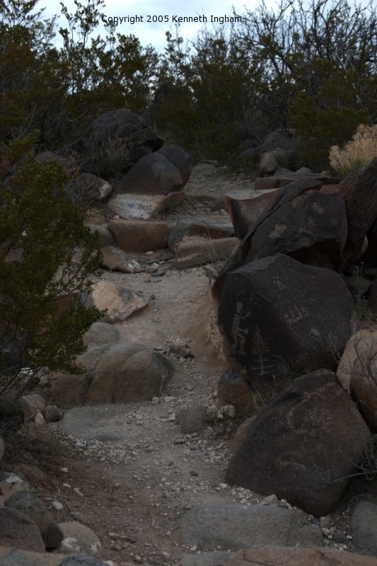
The petroglyphs are right beside the trail.
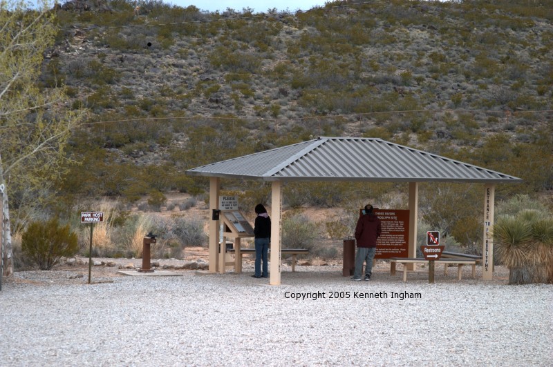
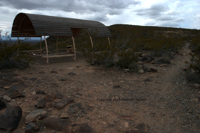
When you reach this shelter, you are at the end of the official hike. The guidebook says that there are fewer petroglyphs after this. However, a ranger said that many of the best and most intricate are beyond this point. We will re-visit and continue on next time.
shelter at the end of the official trail
petroglyphs and mountains in the east.
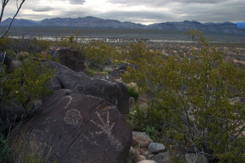
While you are looking at the petroglyphs, you might look up once in a while to see the mountains in the distance (both east and west).

Plants we saw along the trail:

Reader comments about this hike:

On Sat May 13 15:37:10 2006 Chuck from Alamogordo, NM said:
One of my favorite short hikes. Every visit finds petroglyphs we have not seen before. I especially enjoy bringing relatives here that live in the East. About halfway through the walk they realize the only sounds are those of the wind and their steps on the ground. A joy to both the eyes and ears.

On Thu Dec 28 13:18:32 2006 Joni Foster and David McKenzie from Apache Junction, Arizona said:
I've been to Three Rivers three times, in 1999, 2001, and just a few weeks ago in 2006. I find new petroglyphs every visit, and take a lot of photos. You'll be pleasantly surprised if you keep in hiking past the end of the trail. I've heard the BLM in Las Cruces has a catalog of sorts of all of the writings or markings. There are two books written by Joe Ben Sanders which purport to interpret their meaning, which are very interesting. I don't know if his work is recognized as authoritative. After leaving, I always wish I had allowed more time here. I am concerned that there appears to be modern day graffiti being added, and the area appears in the last 6-7 years to have suffered from a number of careless visitors trampling all over the writings and even moving rocks. This place is defintely worth the visit; take plenty of film! You will see more if you avoid the direct sun and go in morning or afternoon. New restrooms are onsite, and there are picnic shelters and grills.

On Mon Apr 16 17:03:40 2007 Sharon from Canada said:
Hi There,

Just traversing the ethernet... stopped by to look at your beautiful petroglyphs... I was born in a place called Three Rivers...South Africa...it is just as beautiful. The Cross and Circle in your photograph is a way of orienting yourself with the rising and setting sun...it measures 24 hours. I have an apple tree in my garden, the base of which is my sundial. I have set my stones according to the summer equinox. Same principal.

Have a wonderful love filled life3

On Wed Apr 25 20:52:27 2007 Monica from Tucson, Az said:
I visited three rivers in March and loved it. I arrivedafter a small storm had went thru about an hour before sunset. The air was cool and crisp, and the sights beautiful. I was amazed at the petroglyphs. I havebeen to many sites in Az surrounding areas, but these petroglyphs wwere beautiful. I loved the mimbres style that was prevalent. I took many pictures at sunset and camped the night and took the full hike the next morning. I cant wait to go back!

Add your comments about the Three Rivers Petroglyphs hike.

Visitors since the counter started: 6197


Copyright © 1997-2007 Kenneth Ingham Consulting, LLC.

For details about the copyright, see the full Copyright statement.

Unhappy? Thinking of suing us? Read this disclaimer.

You can read our privacy statement.


Comments? Send them via the suggestion form.